|  | 
  
  | The Wayland Mayo StoryBiographical Notes
 | 
  
  | DISCHARGE & PRIVATE EMPLOYMENT | 
  
  | Discharge came next, with the problem of what to do. I decided to continue 
   as an aerial mapper, both as a pilot and photographer. I continued my training in instrument, night flying, 
   even some limited aerobatics. I rented planes from North Perry Airport in Miami. I was working as Professional 
   Photographer for the Miami Seaquarium, and on the side rented a 172 and shot a lot of pictures of the 
   airports and businesses to make a few bucks. | 
  
  | 
    I saw an ad in the Miami Herald that Rader And Associates, a large engineering company, 
   wanted an aerial mapping Photographer. I applied and got the job.This was 1958. Rader had offices around 
   the world. They were using a Cessena 180 and an AT- 11. As I got my feet wet in this new job, I found 
   ways to continue to practice and develop my piloting skills. 
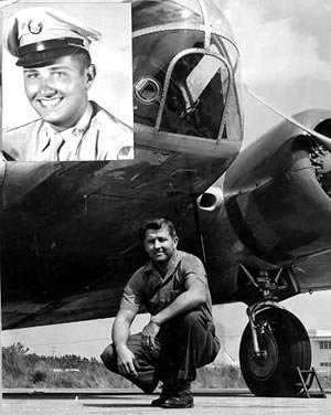
     |  A composit photo illustrating a transitional period in my life  from military to civilian 
      . The top photo was taken in 1948 at Lackland AFB. The main larger photo was taken in Miami, Florida, 
      in 1958 while I was working for Rader.
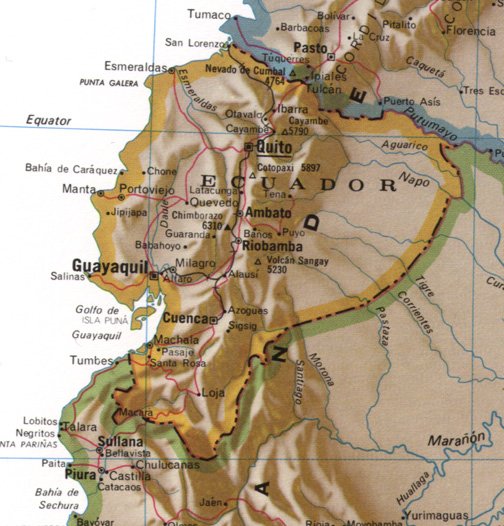
 |  As a mapping photographer, I was essentially in charge of the aircraft for each mission. 
    Every pilot that I flew with was happy to let me preflight the plane, file the flight plan, and do the 
    flying to and from the project. I am an accomplished mechanic and in many instances did maintenance 
    on the plane. They bought an AT-11 to do a mapping project in Ecuador. The plane arrived with no camera 
    porthole, and the aircraft needed a complete nose cone. I was able to accomplishe a lot of this work 
    to get the camera mounted without outside assistance.
   | 
  
  | The Rader Company had large projects and an office in Ecuador. I soon found myself 
   flying from Miami to Panama, on to Guayaquil and then to Quito. From Guayaquil to Quito was very mountainous 
   and also dangerous, as the airport at Quito is almost 10,000 ft. At that time there were no navigational 
   aids and very little communication, and I was mapping uncharted jungle. I was in charge of obtaining acceptable coverage on these trips and the Chief Pilot 
    allowing me to fly to and from the project on virtually every flight. It was primarily my job to locate 
    the project, make sure the aircraft was always on line, accomplish the photography, process and check 
    the film. We used the lab at El Instituto Geographico Militar, where I also instructed them 
    in lab work. I can barely order a hamburger in Spanish and none of them spoke English; but, we got the 
    job done. We made several flights from Miami, to Montego Bay, to Panama, to Quayaguil, to Quito Ecuador 
    so I got a lot of hours in the twin Beach. 
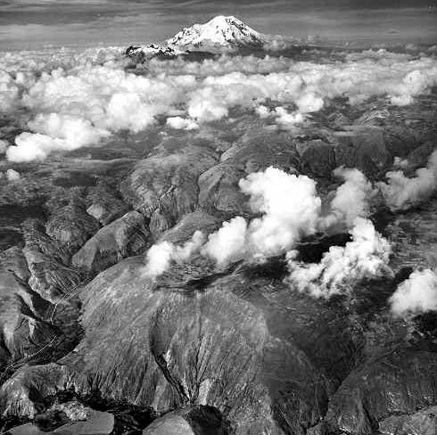
Our work was supporting the efforts of the Equadorian El Instituto Geographico Militar 
    at the time of an attempted government overthrow. We were advised to leave immediately as the situation 
    was explosive. Arriving at the plane we found armed guards, refusing us access to the AT-11. My boss 
    was able to bribe them and we quickly took off for Guayaquil. Gassing up there we were soon on our way 
    back to civilization. Government overthrows are not uncommon in South American countries. I was always 
    afraid to tell anyone who I worked for.
   | 
  
  |  | 
  
  | This map, depicting the South American country of Ecuador as its central focus, was 
   reproduced from the Readers Digest Atlas of the World, a Rand McNally Map publication. | 
  
  | 
    The jungles in Ecuador are inhabited by the Jibaro Tribe. They are headhunters, also there 
   were reports of cannibalism. Ecuador was always covered with clouds, with several mountains close to 
   20,000 ft. Mt. Chimborazo always sticking up ominously through the clouds. Cotopaxi is the highest active 
   volcano in the world. I always figured every cloud had a rock in it. I made numerous flights to Quito, 
   at times instructing their military on lab procedures. They received thousands of dollars worth of equipment 
   from the U.S. and never knew how to install it. I was able to get everything uncrated and up and working. 
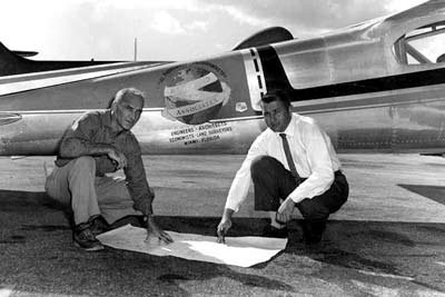
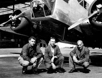
     |  Wayland and Boss, ready for trip to Ecuador in AT-11
 |  | 
  
  |  | 
  
  | View across the Ecuadorian landscape from 20,000 feet. In all truth, this photograph is one of those I prize the most. It was 
    selected as the cover of the annual Photogrammetric Engineering Yearbook in 1960. 
   | 
  
  | 
    I was always fascinated when an ancient corrugated JU-52 tri-motor that frequently came 
   in for a landing in Quito, discharging passengers carrying chickens, pigs, etc. This plane was later 
   purchased I believe by Martin Caidin and flown to the U.S. 
     |  By no means was all of my work with Rader located in Ecuador.
 Here my Boss and I are planning a Bahamas mission where we will be using the Cessena 180
       |  | 
  
  |  |