CHINA SHOOTS DOWN ORBITING SATELLITE
What Does This Mean To The United States?
Part 1
On Jan. 12, 2007, the United States inherited a problem that is bigger and conceivably
more catastrophic than Pearl Harbor. Very few Americans even know about it, nor do they care. It was not
even listed on the front page of the newspaper, and the White House covered it up as long as they could.
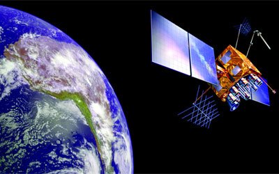
China had launched an anti-satellite missile which destroyed a weather satellite orbiting in space.
 |
Tony Snow of the White House, made the understatement of the year when he said "we are concerned about it, and we've made it known." The U.S., as usual, made only a few comments. The missile was launched by China's Central Military Command in Beijing. The New York Times reported that the U.S. has a number of low-orbit military satellites in space, used for communications and for navigation of "smart bombs." U.S. officials said the Chinese missile reached as high as some of those satellite's orbit. It was the first time in history that a missile launched from the ground destroyed an orbiting satellite. China's work on an anti-satellite system has been known by the U.S. Last August, China fired high-power lasers briefly blinding U.S. spy satellites orbiting over its territory. The significance of these events show that China is ahead of the U.S. in technology, as they expand their military presence. The U.S. must realize the consequences if China shot down all of our satellites. The average American does not realize what part our Global Positioning System plays on our very existence. If such an event did occur the U.S. would be hard pressed to offer any resistance to an attack. The purpose of this story is to disclose the areas that would be damaged by such an attack.
What is GPS?
GPS is a Global Positioning System developed by the U.S. Department of Defense to provide all-weather around
the clock navigation capabilities for military ground, sea, and air forces. Since its implementation it
has become an integral asset in numerous civilian and industrial applications. GPS employs 24 satellites
in 20,200 km circular orbits. These spacecraft are placed in 6 orbit planes with 4 operational satellites
in each plane. One launch failed in 1981, however the 24 satellite constellation was completed on March
9, 1994. The satellite's receivers use triangulation to determine their location. The cost of maintaining
the system is approximately 400 million a year.
GPS orbiting satellite, Wikipedia
The GPS receiver calculates its position by measuring the distance between itself and 3 or more GPS satellites. The time delay between transmission and reception of each GPS radio signal gives the distance to each satellite. By determining the position of and distance to at least 3 satellites, the receiver can compute its position using trilateration. The satellites are orbiting the earth about 12,000 miles above us. They are constantly moving, making two complete orbits in less than 24 hours. The satellites are traveling roughly 7,000 mph. Satellites are powered by solar energy. They have backup batteries onboard when no solar power is available, such as a solar eclipse. Small rocket boosters keep them flying in the correct path.
It will not be difficult to show the importance of this system in every aspect of our
life. Our Army, Navy, and Air Force utilize GPS as an absolute necessity. Our worry over increasing military
buildup in Korea, Iran, and now China is genuine. Remember when our U2 was making repeated flights over
Russia ? Our government was not concerned because "They fly so high no missile can reach it."
But look what happened. A Russian missile slammed into a U2 flown by Gary Powers and destroyed it. Our reasoning
with the satellites was the same as the U2. "They orbit so high nothing can reach them." This
type of thinking is very dangerous to our health. The laser beam has been a project for years, and has now
progressed to a dangerous level. So let's take a look at only a few uses of GPS.
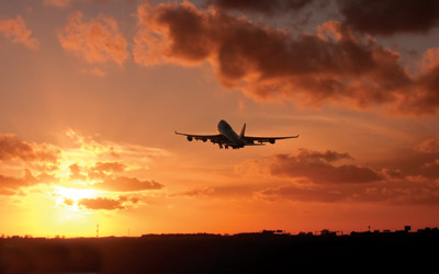
AVIATION
Aviators throughout the world use the Global Satellite System (GPS ) to increase the safety and efficiency
of flight. With its accurate, continuous, and global capabilities, GPS offers seamless satellite navigation
services that satisfy many of the requirements for aviation uses. Space based position and navigation enables
three-dimensional position determination for all phases of flight from departure, en-route, and arrival,
to airport surface navigation. New and more efficient air routes are continuing to expand, saving time and
money. Improved approaches to airports, which significantly increase operational benefits and safety, are
being now being implemented even in remote locations
AIRLINE TRAFFIC, SOURCE: FAA
| next page >> |